Home · Sights · La Salve Bridge
La Salve Bridge
What you are looking at
Abando · Campo Volantín
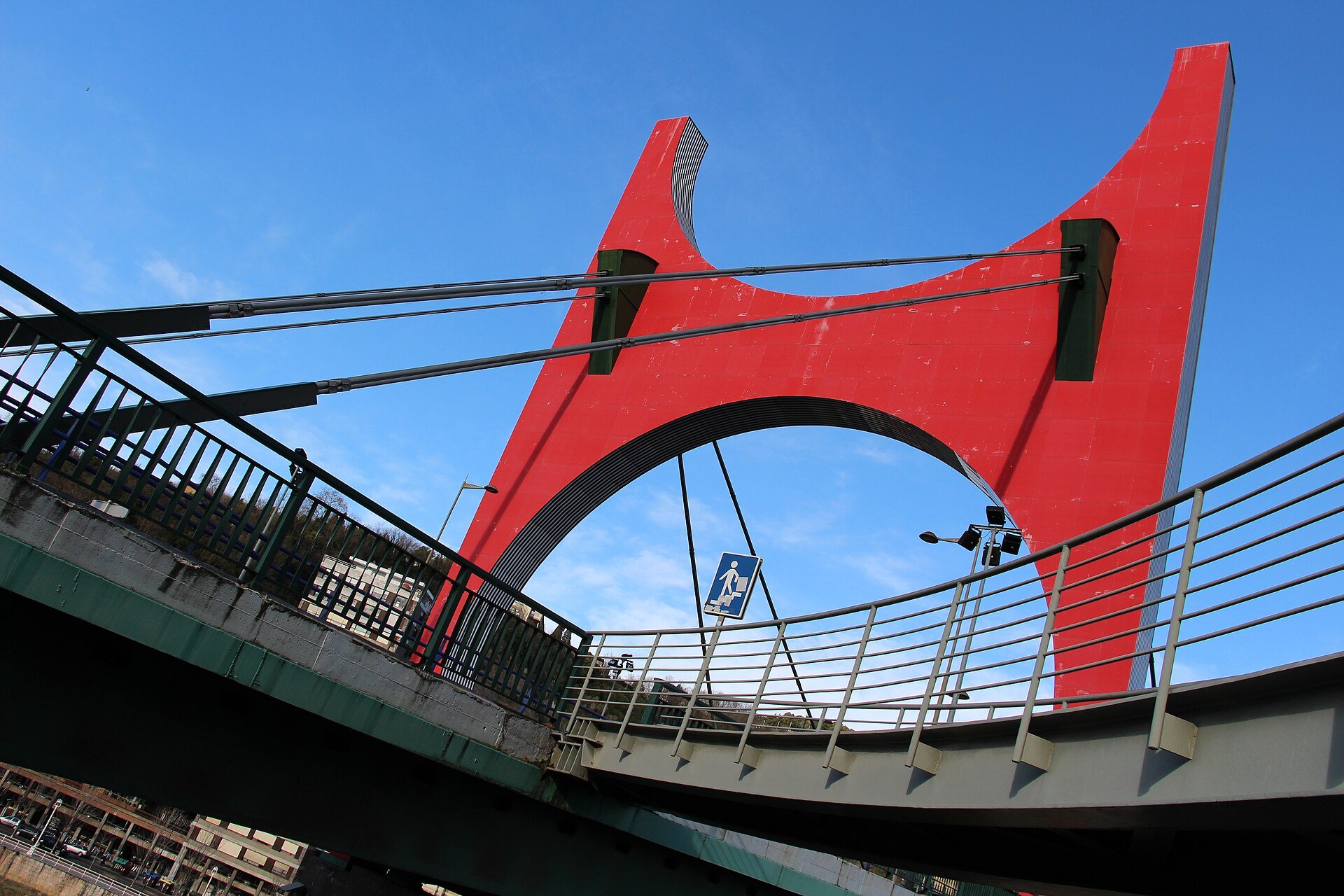
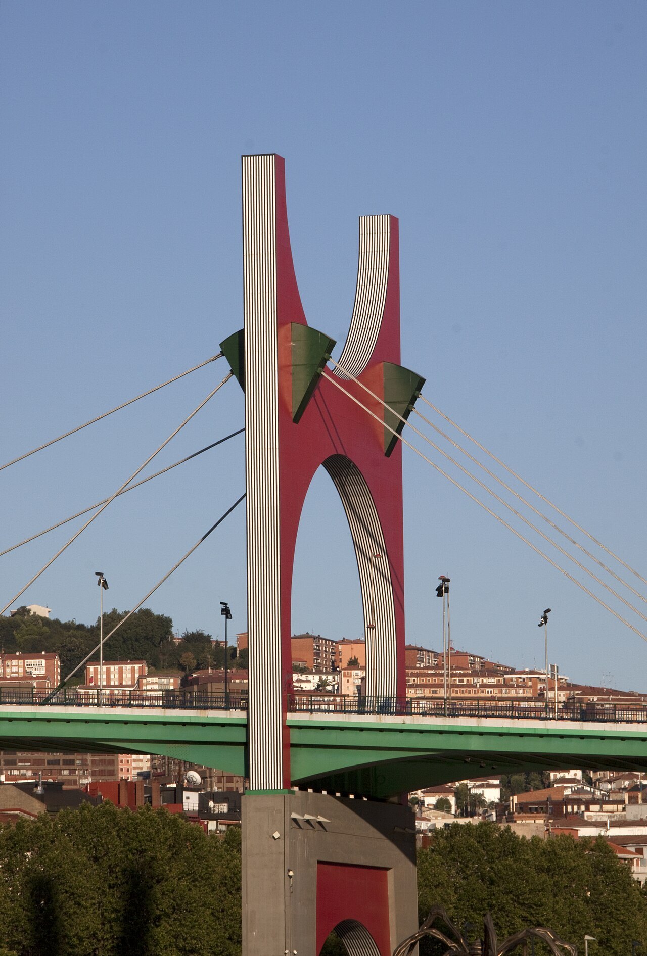
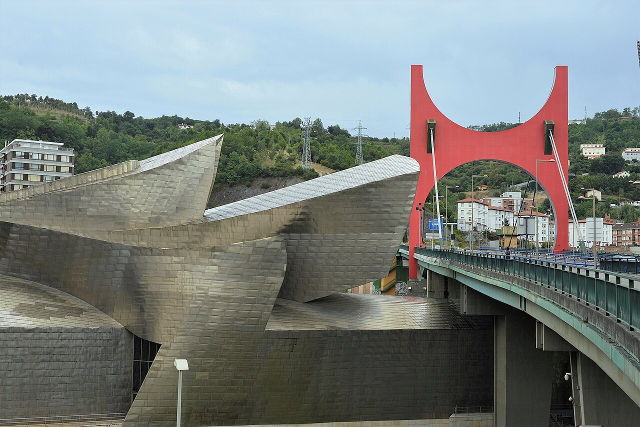
- 1The red archDaniel Buren's red portal over the roadway, made in 2007 for the museum's tenth anniversary.
- 2The cable staysSpain's first cable-stayed bridge, its metal deck hung from a single tall mast.
- 3The museum towerGehry's stone and steel tower beside the bridge, with stairs down to the museum.
- 4The public liftsFree lifts from the right-bank promenade at the foot of the bridge up to the deck.
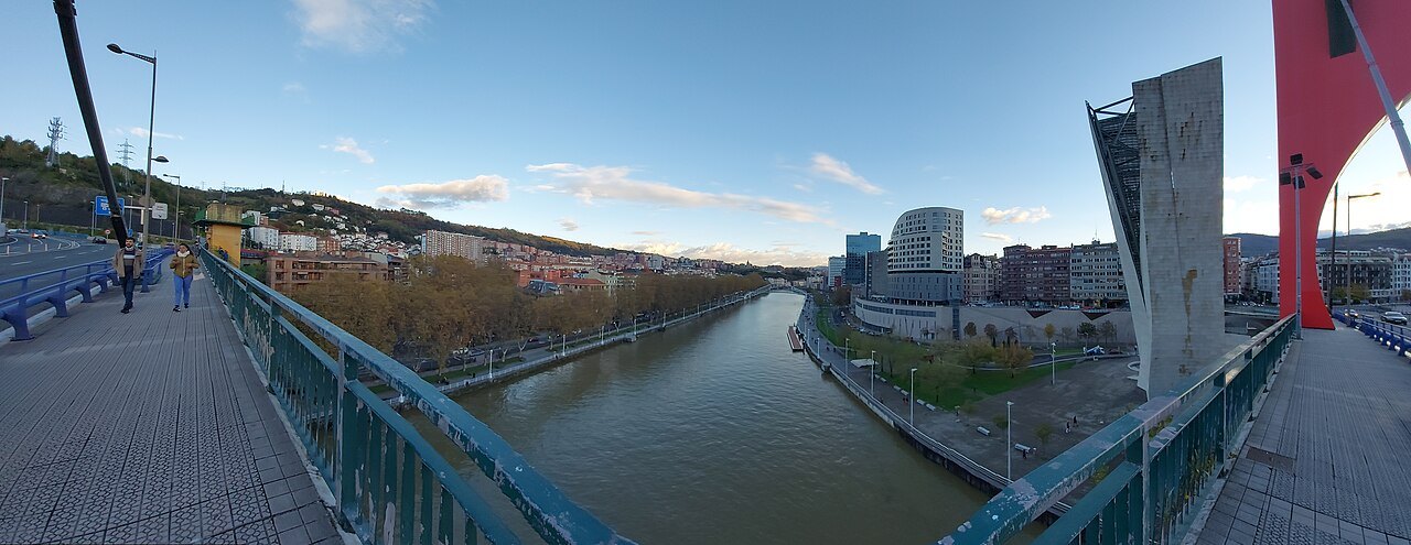
- 5The view upriverFrom the deck, the Ría bending past Zubizuri toward the old town and the hills.
- 6The view of the museumThe titanium roofs seen from above, close enough to touch from the walkway.
Reading the place
The sight in full
Why it matters
Puente de La Salve, Salbeko Zubia in Basque, carries a road across the Ría between the Campo Volantín promenade on the right bank and the Abandoibarra side on the left. Until 2016 its official name was the Bridge of the Princes of Spain, but everyone in Bilbao called it La Salve, and that is now its name too.
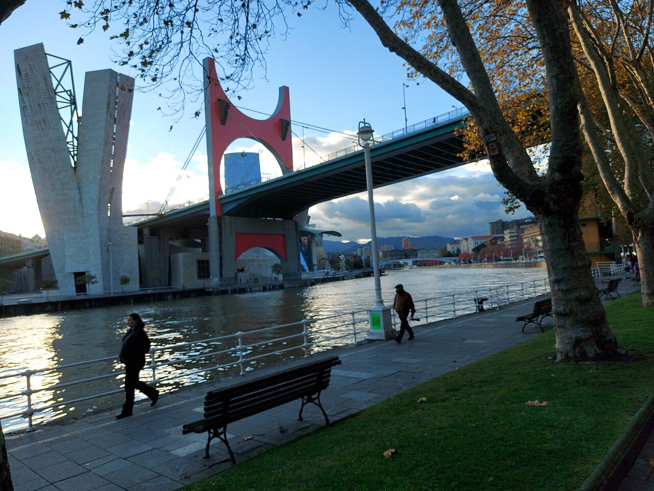
It is the bridge in most photographs of the Guggenheim: the museum was designed to wrap around it, and since 2007 a red arch by the French artist Daniel Buren stands over the roadway like a frame. Of the seventeen bridges inside the city boundary it is the one most visitors cross without noticing that they are crossing a bridge at all.
Why it is called La Salve
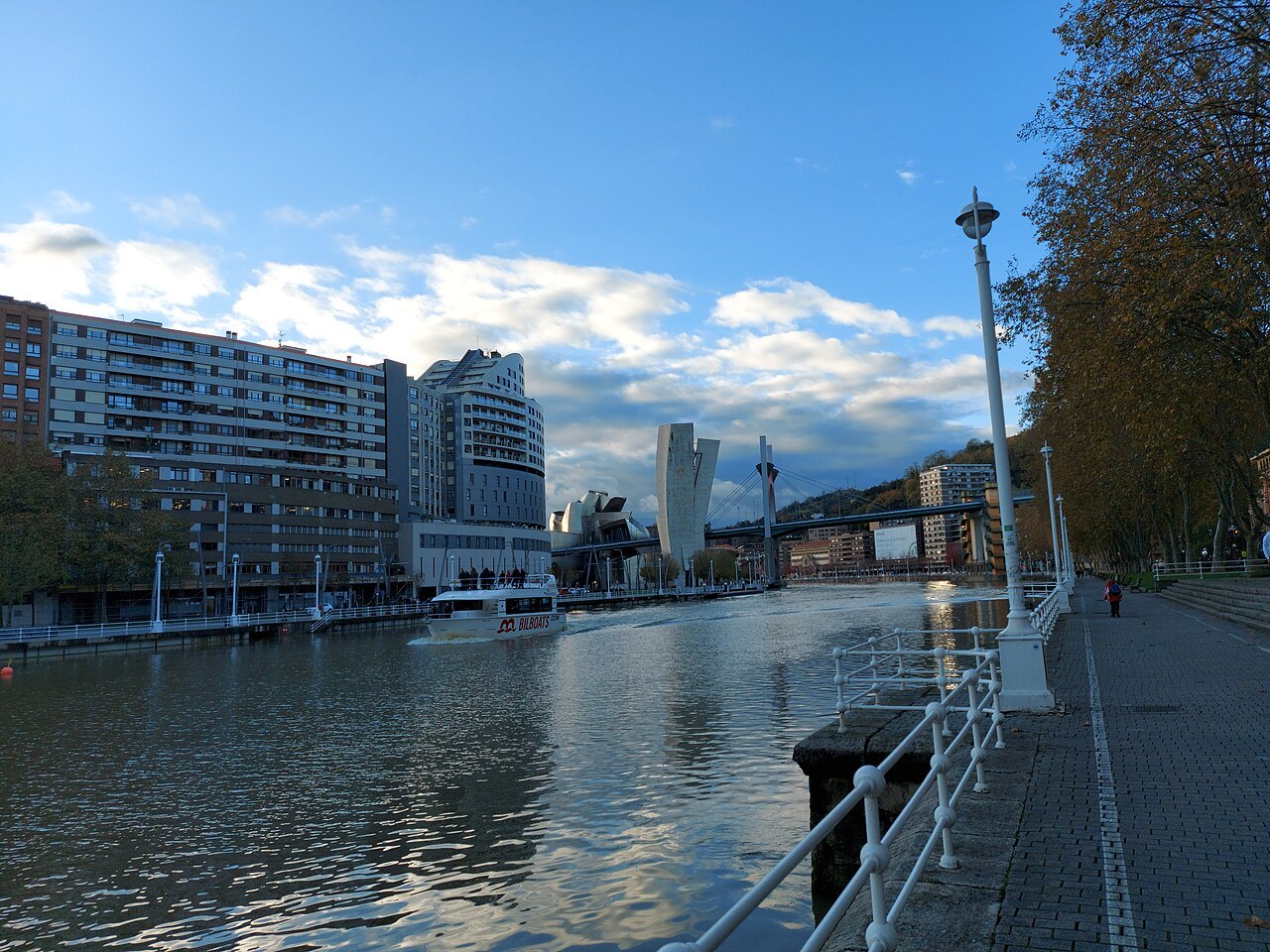
The name comes from the river traffic of the old port. Ships coming up the Ría to Bilbao reached this point and, at the bend, sailors saw for the first time the shrine of the Virgin of Begoña on its hill above the town. There they sang the Salve, the hymn to the Virgin, in thanks for a safe arrival.
The custom gave its name to the spot on the right bank, La Salve, at the end of the Campo Volantín promenade, and the bridge took the name of the place. The Basilica of Begoña is still on its hill, and from the riverside walk you can see why it was the first landmark a sailor would look for.
An engineering first
The bridge was planned at the end of the 1960s to relieve traffic, which was beginning to choke the north of the city, and it opened on 9 January 1972. Its designer was the engineer Juan Batanero García-Geraldo. It was the first cable-stayed bridge in Spain and one of the few with a metal deck, hung from stays fanning out from a single tall mast.
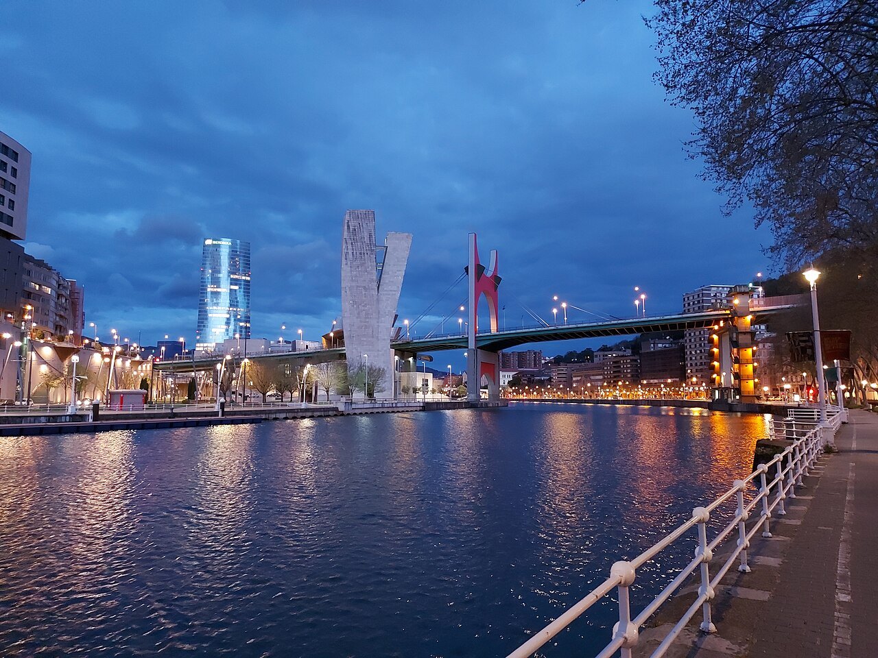
The bridge is fixed, not opening, and was built high enough above the water, about 23 meters, to let ships pass under it to the port that then still reached the city center. When the port moved downriver and the docks closed, the bridge was left standing over an empty industrial edge, which is the land the museum was built on.
The bridge and the museum
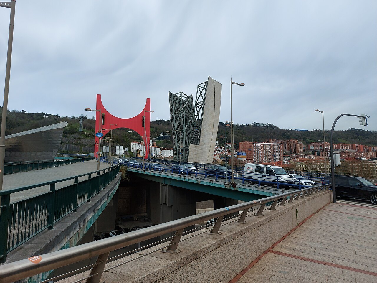
Frank Gehry did not hide the bridge; he used it. The museum's galleries run underneath and beside the deck, and on the side facing the old town Gehry built a tall tower, with stairs that lead down to the museum, so that seen from Campo Volantín the road, the tower and the titanium seem to be one building. Walking across the deck, you look down onto the museum's roofs from only a few yards away.
In 2006 a design by Daniel Buren won the competition the museum held for its tenth anniversary, and in 2007 the red portal called the Arcos Rojos, red arches, was added to the bridge. It brings the bridge into the museum's curving forms with a single bright line, and it was restored in 2017 for the museum's twentieth anniversary.
What you see
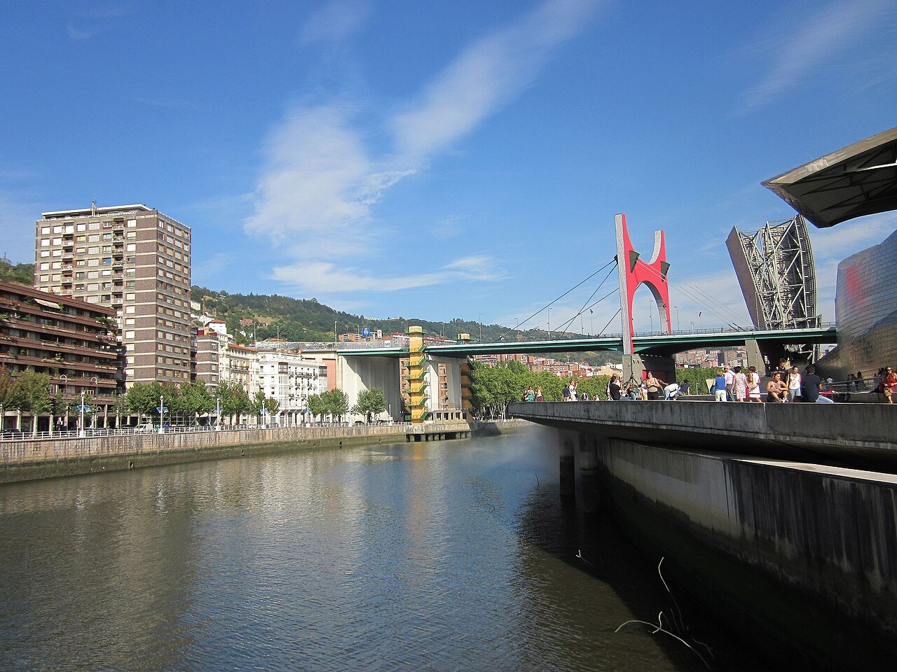
From the right bank, at the foot of the bridge, you see the whole composition: Maman and the museum's river front, the tower, the deck and the red arch, with the hills behind. This is the classic view, best in the early morning or in the evening when the titanium catches the low sun.
Up on the deck, the view runs upriver along the bend of the Ría toward Zubizuri, the Isozaki towers and the old town, and downriver past the museum toward the Deusto district on the right bank and Abandoibarra on the left. The red arch itself is best seen from the pavement as you pass under it.
One of seventeen bridges
Seventeen bridges cross the Ría within the city boundary, and La Salve sits in the middle of a short stretch that shows several generations of them. Upstream is Calatrava's footbridge of 1997; a little downstream is the Deusto bridge, a bascule bridge opened in 1936 and modeled on the Michigan Avenue Bridge in Chicago, built to lift for ships. La Salve, fixed and high, belongs to the years when traffic, not shipping, decided how the city crossed its river.
How to visit
You do not need a plan to see La Salve; it is part of any visit to the museum. Walk the right-bank promenade of Campo Volantín downstream from Zubizuri, look across at the museum, then take the public lifts at the foot of the bridge up to the deck. They are run by the city, carry some 200,000 passengers a year, and have been free to use since 2008.
Cross the bridge on its pavement to the left bank and take the museum's stairs down from the tower, or continue along the road toward the Ensanche. The riverside tram stops at Guggenheim on the left bank, a short walk away; the getting around page explains the tram.
The bridge carries heavy traffic and its pavements are narrow in places, so the best place to stop and look is on the riverside walks below rather than on the deck.
Honest notes
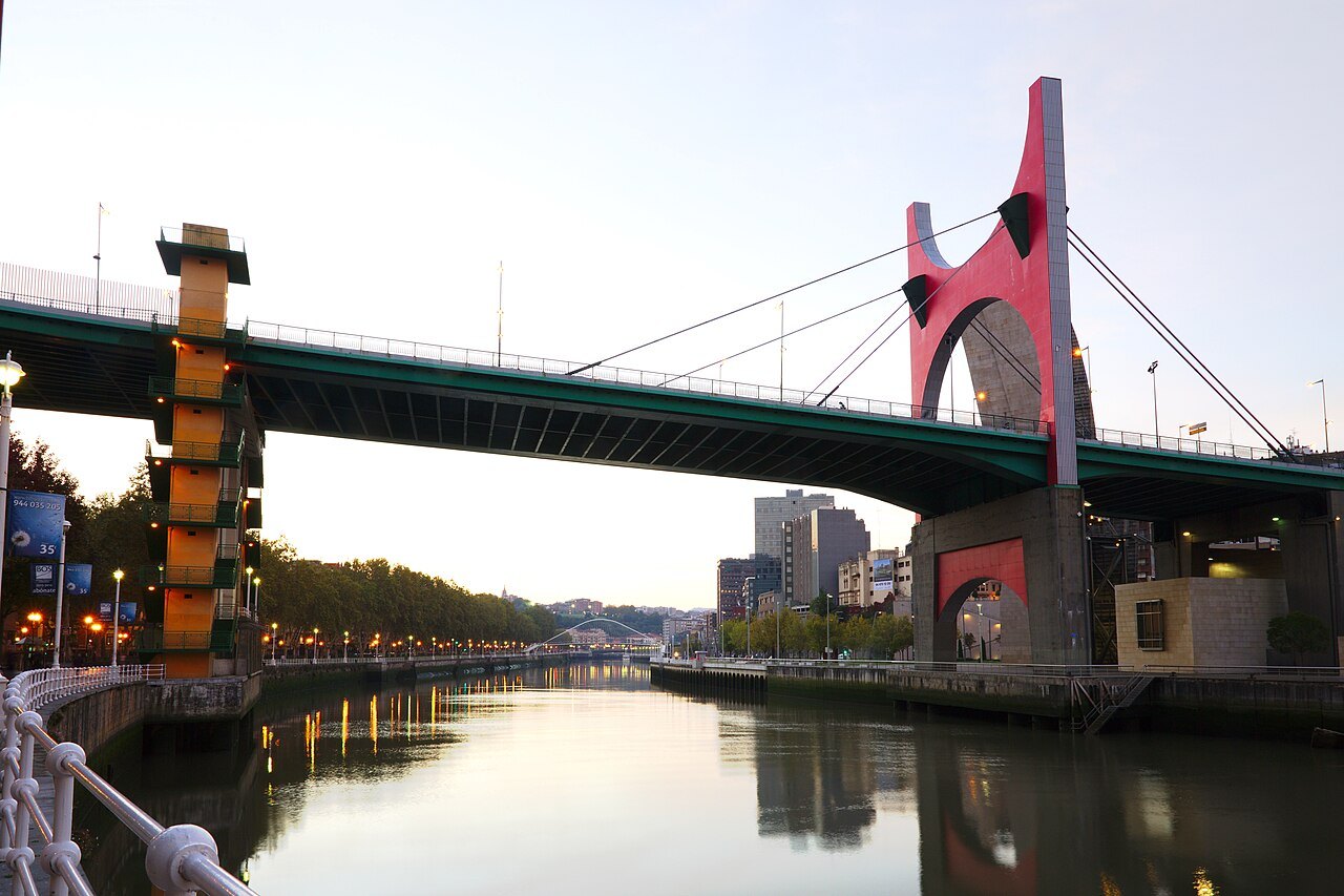
The red arch is an artwork made for the museum's anniversary, not part of the bridge's original design, and opinions on it in Bilbao were divided. For most visitors it is simply part of the picture now, and it does what Buren intended: it ties a plain road bridge of the 1970s to the most famous building in the city.
Nearby
Where to go next
- Nearby · Abando · left bankThe GuggenheimFrank Gehry's museum of modern and contemporary art, a cluster of titanium curves on the left bank of the Ría, opened in 1997 on what had been the run-down edge of the city's port.Read the page →
- Nearby · Campo Volantín · UribitarteZubizuriSantiago Calatrava's white footbridge of 1997, a curved deck hung on cables from a single tilted arch, which carries the walk from the right bank to the museum side of the river.Read the page →
- Nearby · Abando · left bankAbandoibarraThe riverside strip of shipyards and railway yards below the Ensanche, rebuilt since the 1990s into a district of museums, gardens and new architecture, with César Pelli's Iberdrola Tower, the tallest building in the Basque Country, at its center.Read the page →