Home · Sights · Artxanda and Its Funicular
Artxanda and Its Funicular
What you are looking at
Above the right bank
- 1The funicularA short, steep railway from the edge of Campo Volantín up the hillside, in operation since 1915.
- 2The lookoutA balcony at the top over the whole city, the river and the hills beyond it.
- 3The big lettersRed letters spelling the city's name in Spanish and Basque along the lookout's rail.
- 4La HuellaA memorial sculpture on the summit, part of the park opened there in 2020.
- 5The summit parkGreen space, a sports area and restaurants on the broad top of the hill.
- 6The walk downA long hillside promenade toward Deusto, built to turn the summit road into a walking route.
Reading the place
The sight in full
Why it matters
Artxanda, Archanda in Spanish, is one of the two ranges of hills that close in Bilbao, the other being Pagasarri to the south. It is the lower of the two, a little under 300 meters, the nearer to the center and the more built-up. Its summit is a broad, green top with a lookout, and it is where people in Bilbao take visitors to show them the whole city at once.
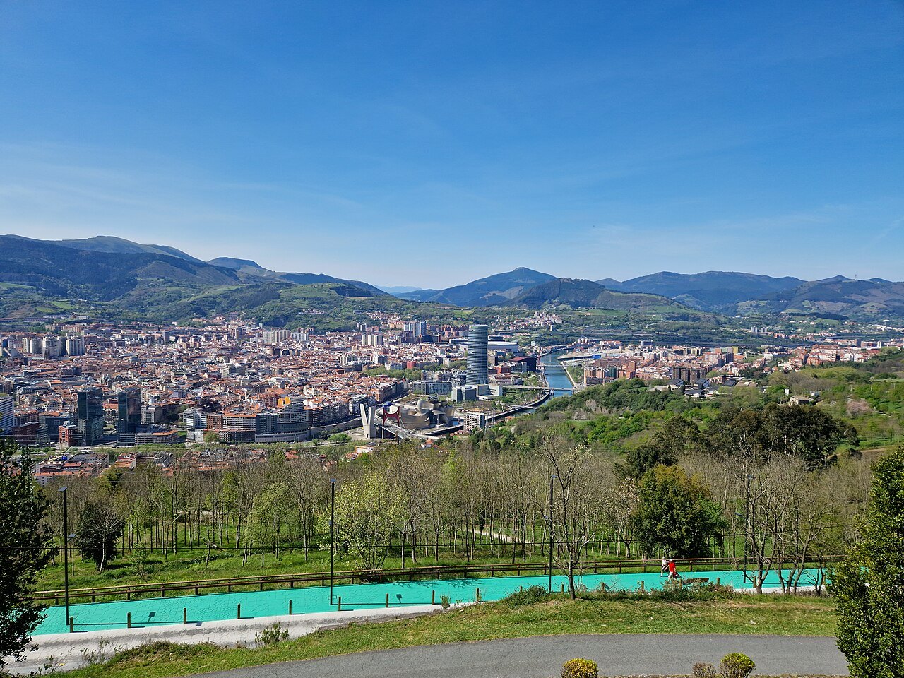
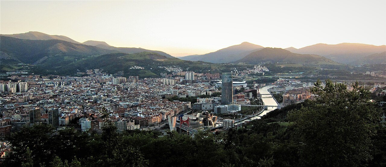
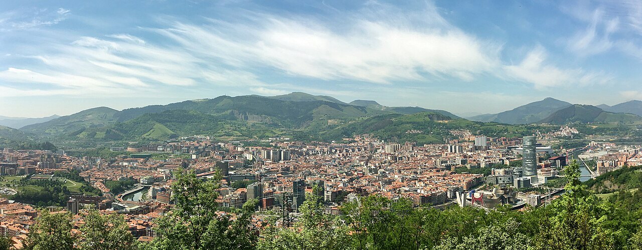
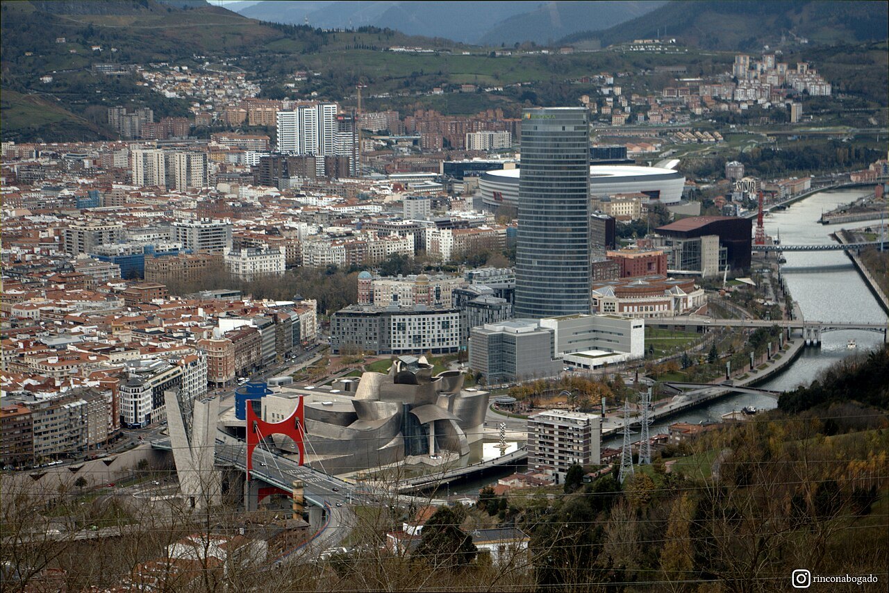
The city sits in a hollow between its hills, which is why its people call it the botxo, the hole, and from the lookout you see exactly what they mean: the Ría winding through the middle, the old town and the Ensanche on either bank, the museum and the tower at the bend, and green slopes rising on every side.
The funicular
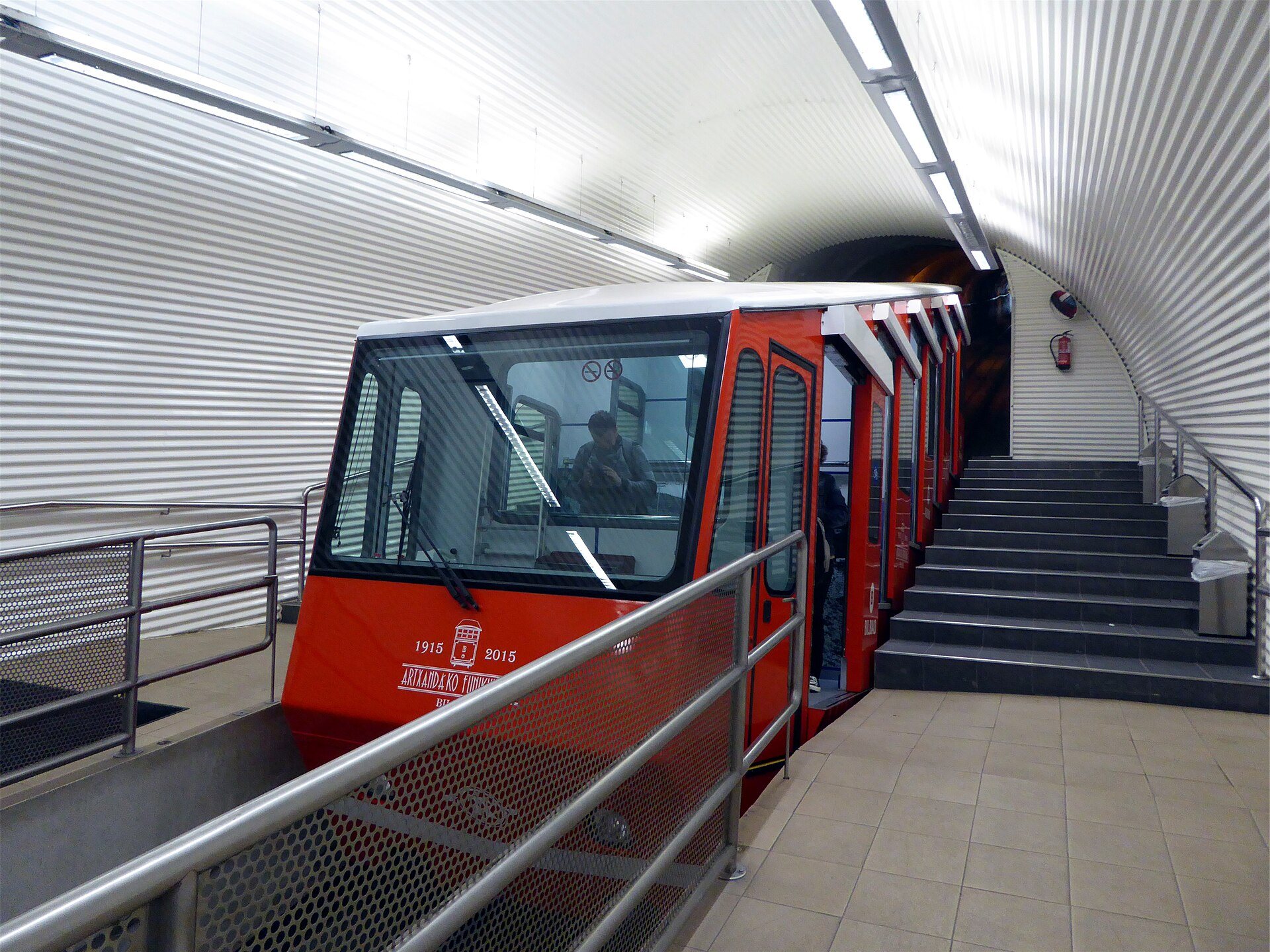
The Artxanda funicular was built by the Swiss company Von Roll on the initiative of Evaristo San Martín, and made its first trip on 7 October 1915. It was built to reach a casino that then stood on the mountain. During the siege of Bilbao in the Civil War the line and the upper station were bombed, and service stopped until 1938.
The private company that ran it went bankrupt and the city took it over in 1939. It closed in 1976 after an accident that injured several staff, reopened in April 1983, was closed again by the flood damage of that August, and returned in November. Today it is run by a company owned entirely by the city.
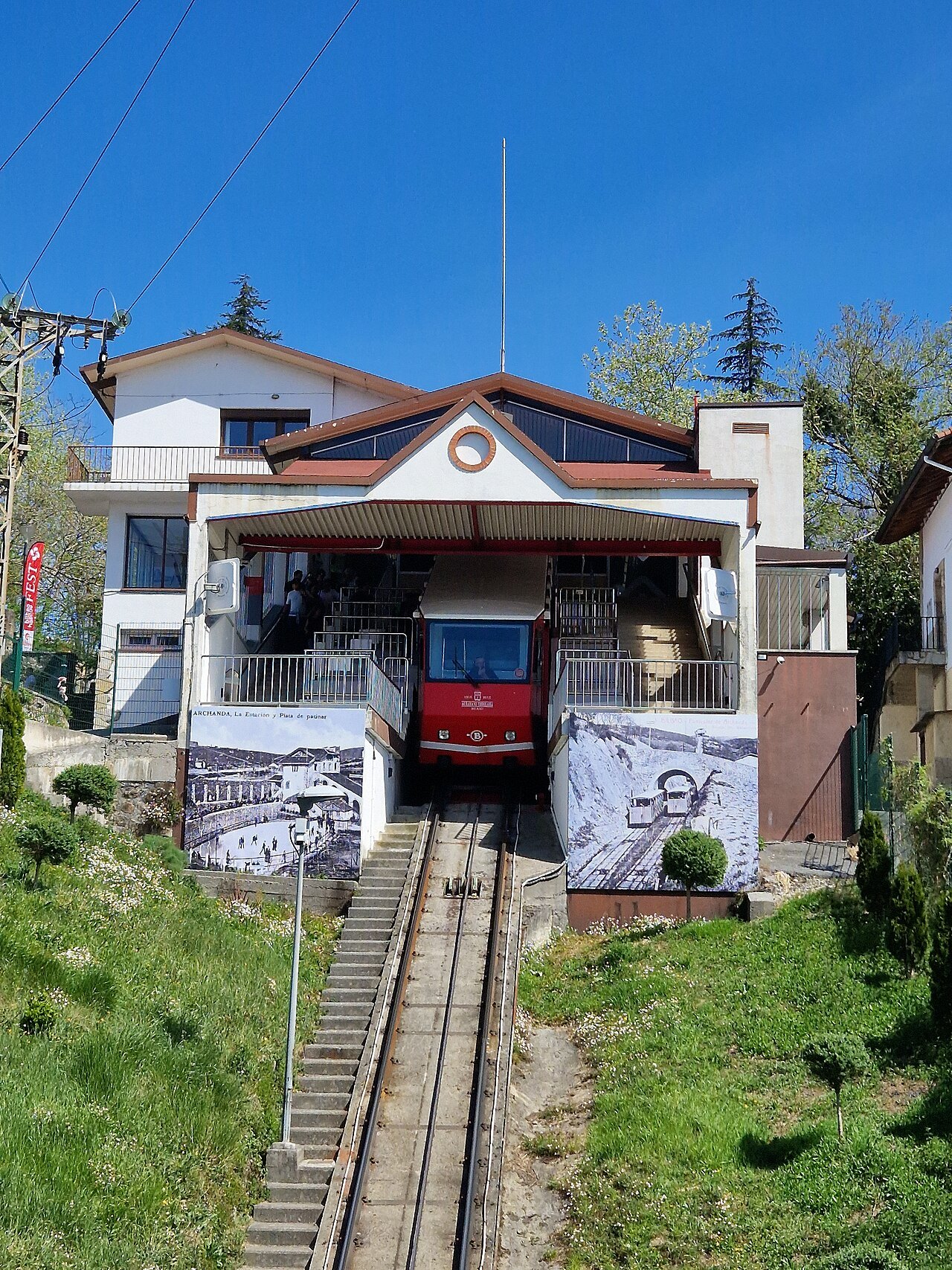
The line is about 770 meters long and climbs about 226 meters, single track with a passing loop halfway, at slopes of up to about 45 percent. Each car holds around seventy people, and the ride takes about three minutes.
Where to catch it
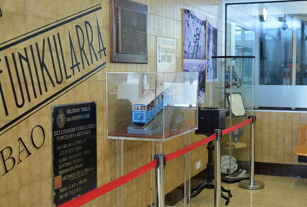
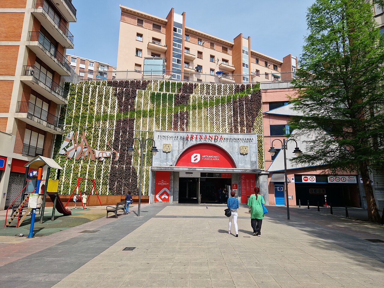
The lower station is on the Plaza del Funicular, just off Castaños street on the right bank, a few steps from the Campo Volantín promenade, between the town hall and La Salve and a short walk north of Zubizuri. From the Guggenheim it is a walk across the footbridge and up a few streets.
Tickets are sold at the stations, and the city's contactless transport card, Barik, can be used too. The cars run frequently through the day, so there is rarely a long wait; the getting around page explains Barik and the other ways up the hillsides, including the public lifts.
What you see at the top
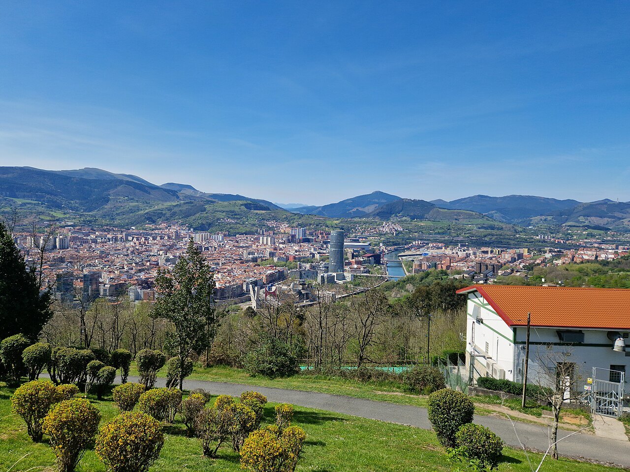
From the upper station walk to the lookout. On a clear day the view takes in the whole bowl of the city: the bend of the Ría below you, the Guggenheim and the Iberdrola Tower on the left bank, the Casco Viejo upstream, San Mamés downstream, and the higher hills of Pagasarri to the south.
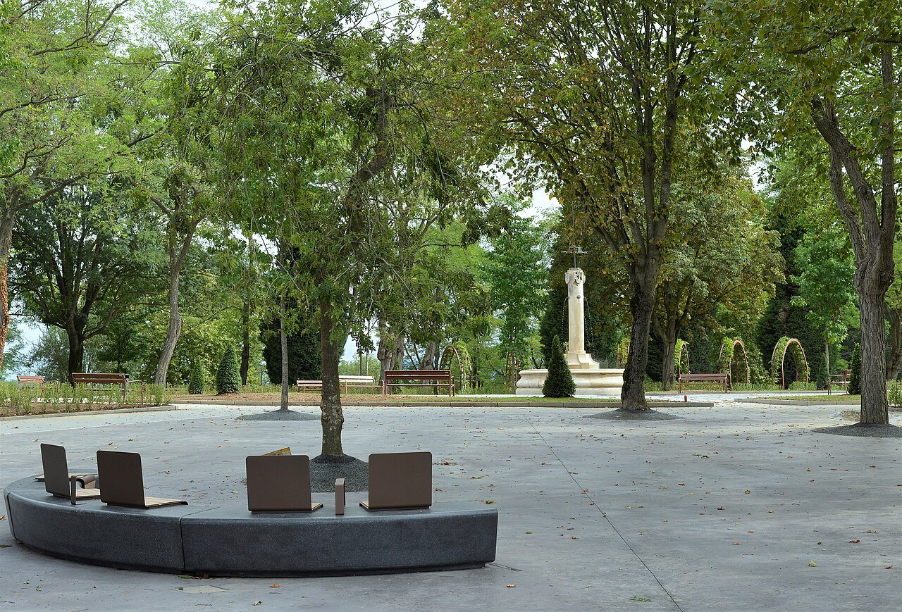
Along the rail stand big red letters that spell the city's name in its two forms, Bilbao and Bilbo, its historical Basque name, and they are among the most photographed spots on the mountain. Nearby, the park opened on the summit in October 2020 brought together the lookout, a central fountain and La Huella, the footprint, a memorial sculpture.
The summit is a recreational area with green space, a sports complex, a hotel and restaurants. In 2021 the city began turning the road along the top into the Artxanda lookout walk, more than six kilometers between Deusto and Santo Domingo, with a safe footpath, places to stop and more viewpoints.
A city between two ranges
Bilbao's center lies between two small mountain ranges with an average height of about 400 meters, and both are part of daily life in the city. Artxanda is the urban one, crossed by roads and dotted with houses and restaurants; the pass of Santo Domingo separates its main summit from Monte Avril, about 400 meters high, to the east.
Pagasarri, across the city to the south, is the walkers' mountain. Hundreds of hikers have climbed it every weekend since the 1870s, and its countryside has been officially protected since 2007. From the Artxanda lookout you can see Pagasarri's green slopes on the far side of the bowl, and the contrast between the two explains a great deal about how close the countryside comes to the city here.
How to visit
Allow an hour or two: a few minutes each way on the funicular and as long as you like at the top. Go on a clear day, ideally in the late afternoon, when the sun is behind you as you look over the city and lights the titanium of the museum.
Pair it with the river walk: cross Zubizuri, ride up, and come back down by funicular to finish at the museum or in the Casco Viejo. Walking down the hillside instead is possible on roads and paths, but it is steep and longer than it looks from the top.
The top is exposed, and Bilbao's weather changes quickly; take a layer even in summer, and if the cloud is low, keep the trip for another day, because the view is the whole reason to go.
Honest notes
The funicular is a short ride, not a scenic journey, and the cars face a tunnel of trees for part of the climb; the reward is at the top. Renovation of the upper station began in June 2024, with new waiting rooms, better access and a lookout of its own, and new, larger cars were planned for the line, so the arrangements at the summit may differ from photographs taken before then.
Nearby
Where to go next
- Nearby · Campo Volantín · UribitarteZubizuriSantiago Calatrava's white footbridge of 1997, a curved deck hung on cables from a single tilted arch, which carries the walk from the right bank to the museum side of the river.Read the page →
- Nearby · Abando · left bankThe GuggenheimFrank Gehry's museum of modern and contemporary art, a cluster of titanium curves on the left bank of the Ría, opened in 1997 on what had been the run-down edge of the city's port.Read the page →
- Nearby · Ibaiondo · right bankThe Casco ViejoThe oldest quarter of Bilbao and the town's original core: seven parallel streets on the right bank of the Ría, with the cathedral, three old churches, the market and the city's busiest bars packed between them.Read the page →